With the approaching long weekend around Ganesh Chathurthi, I was making frenetic preparations to go on a trek. After
scanning several itineraries on GHAC (Great Hyderabad Adventure Club)
Meetup site, I was drawn towards the Rajgad-to-Torna trek since that seemed to
have quite scenic locations, with a moderate-to-difficult level of grading.
Trekking in the Western Ghats around Pune area during the monsoons was long
awaited, as well. Moreover, having read in a few sites that this was a
must-do route for every serious trekker, my choice was made. After a discussion
with Puneet, the organizer, I learnt that this was generally a 3-day trek from
Hyderabad (considering the 10-hour travel to-and-from Pune), but had been constrained
to a 2-day event this time and hence could end up being a little more
strenuous.
As part of preparations for the trek, based on learnings
from my Kodachadri Sunrise trek a week earlier, I took extreme caution to weigh
every single item packed into my rucksack. It was a major exercise choosing,
rejecting and paring down the weight from 13 kg (during the earlier 2-day trek)
to just under 9 kg, of which the rucksack weighed 2 kg in itself! This gave
adequate buffer to add another 2 to 3 kg towards shared weight of the group
such as camping equipment, food etc.
On Friday, the 6th of September
our team of 8 people boarded the bus to Pune at 4 PM. After what turned out to
be an 'eventful' journey of 13 hours, we reached the destination and hired a jeep
to the base village, Gunjavne.
 |
 |
Gunjavne is a nice small village with lots of paddy fields and friendly, helpful villagers. After a breakfast of tasty vada-pav, we started our trek up towards the Rajgad fort. We were saved the burden of carrying the weight of our lunch since the dhaaba owner offered to home-deliver the food directly at the Rajgad fort! Moreover, he offered his visiting card with contact details so that we could call in case we needed walking directions! This initial stretch of the trek was turning out to be more of a heritage tourist walk! Throughout the route and at the Rajgad fort, we found a lot of enterprising villagers selling butter milk, lemonade and other eatables, virtually obviating the need to carry any eatables for people hiking up and down the Rajgad fort. We preserved most of our stuff for the arduous journey beyond Rajgad.
 |
 |
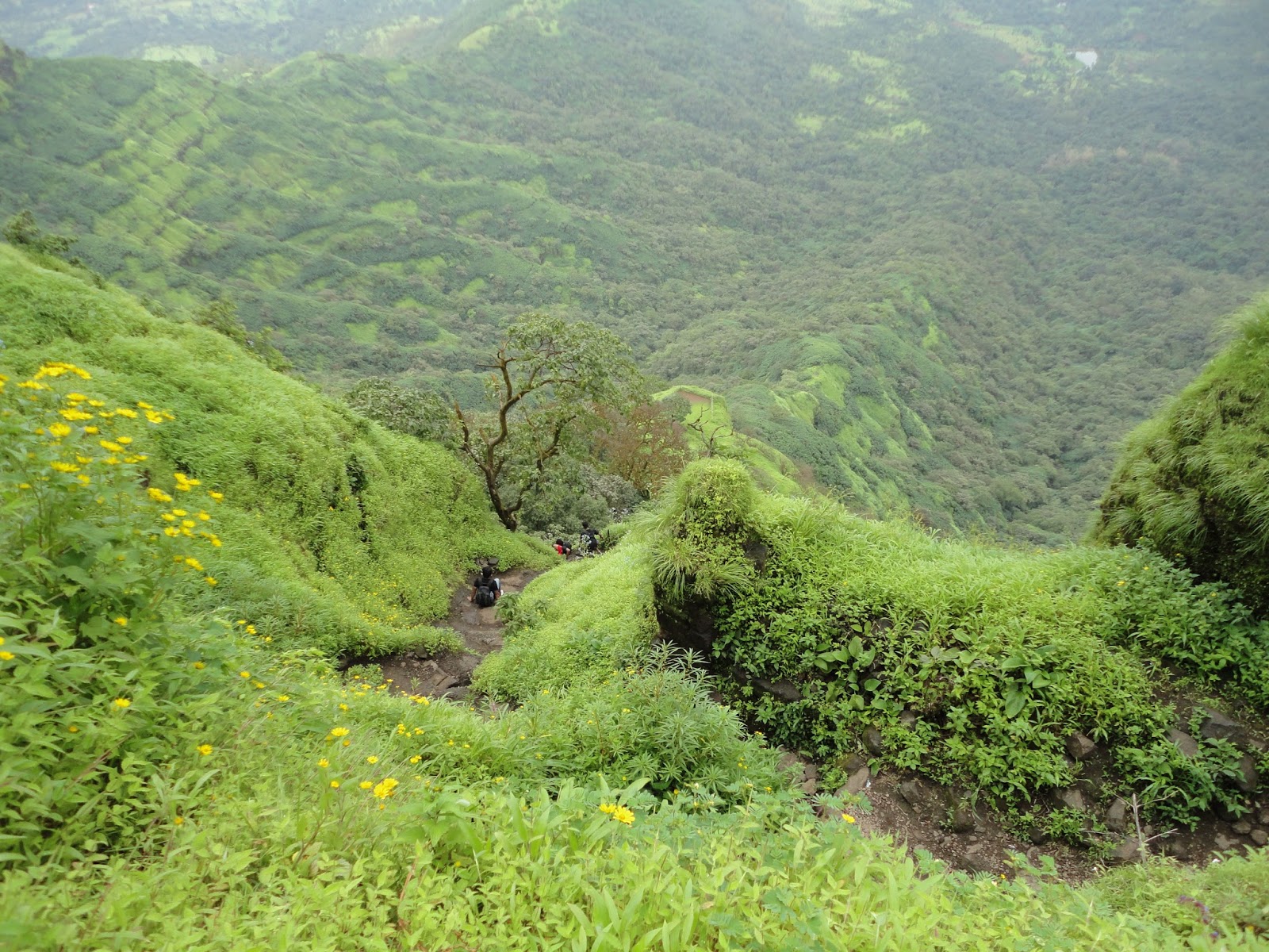
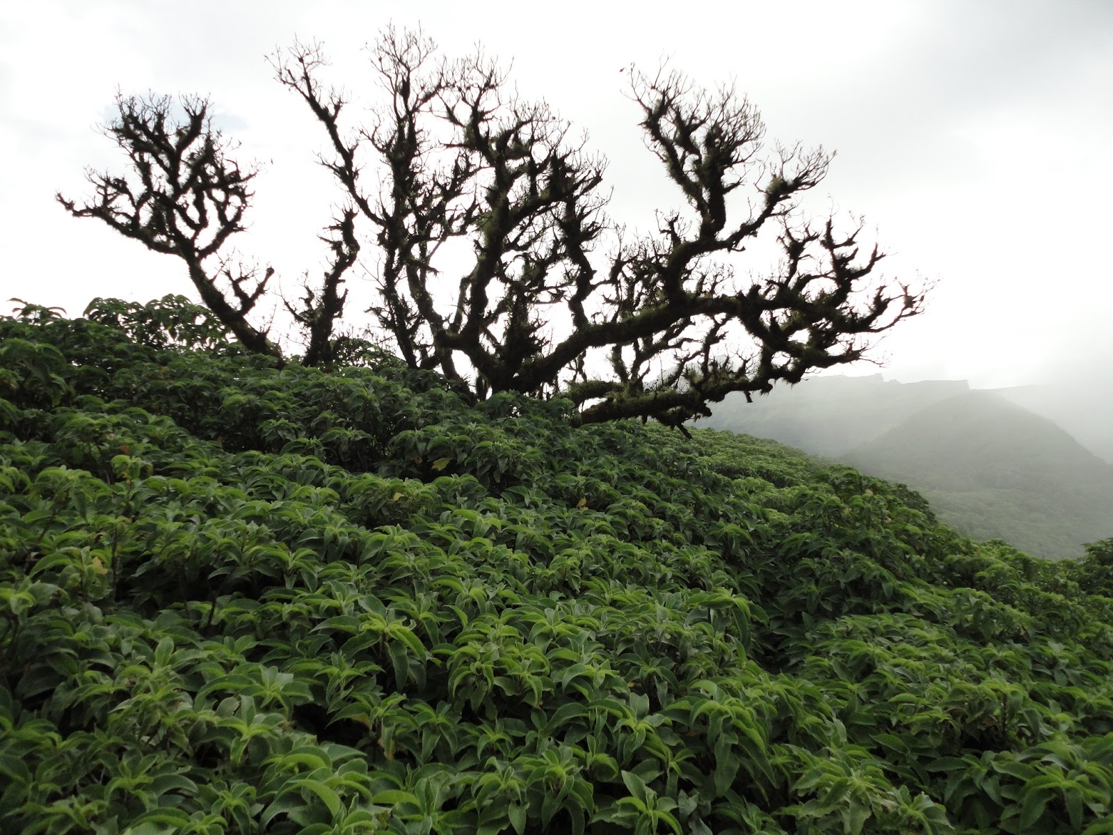
The moment one starts ascending up the trail to the fort, the scenery keeps getting better with each step. There are a series of interconnected hills of varying heights which gradually lead to the highest hill hosting the fort. The landscape is uniformly green-rolled with bright green shrubs and plants of various types and hues.
 |
 |
An eclectic mixture of flowers of varying colors dot the pathway. After a couple of hours of hiking, the outlines of the historic fort walls start emerging from the background. During the monsoon they are difficult to spot from far since the walls are completely covered with moss and enmesh with the surroundings. The beauty of the hills amidst the fertile landscape during the rainy season is really a sight to be seen, for words fail to describe it in its entirety.
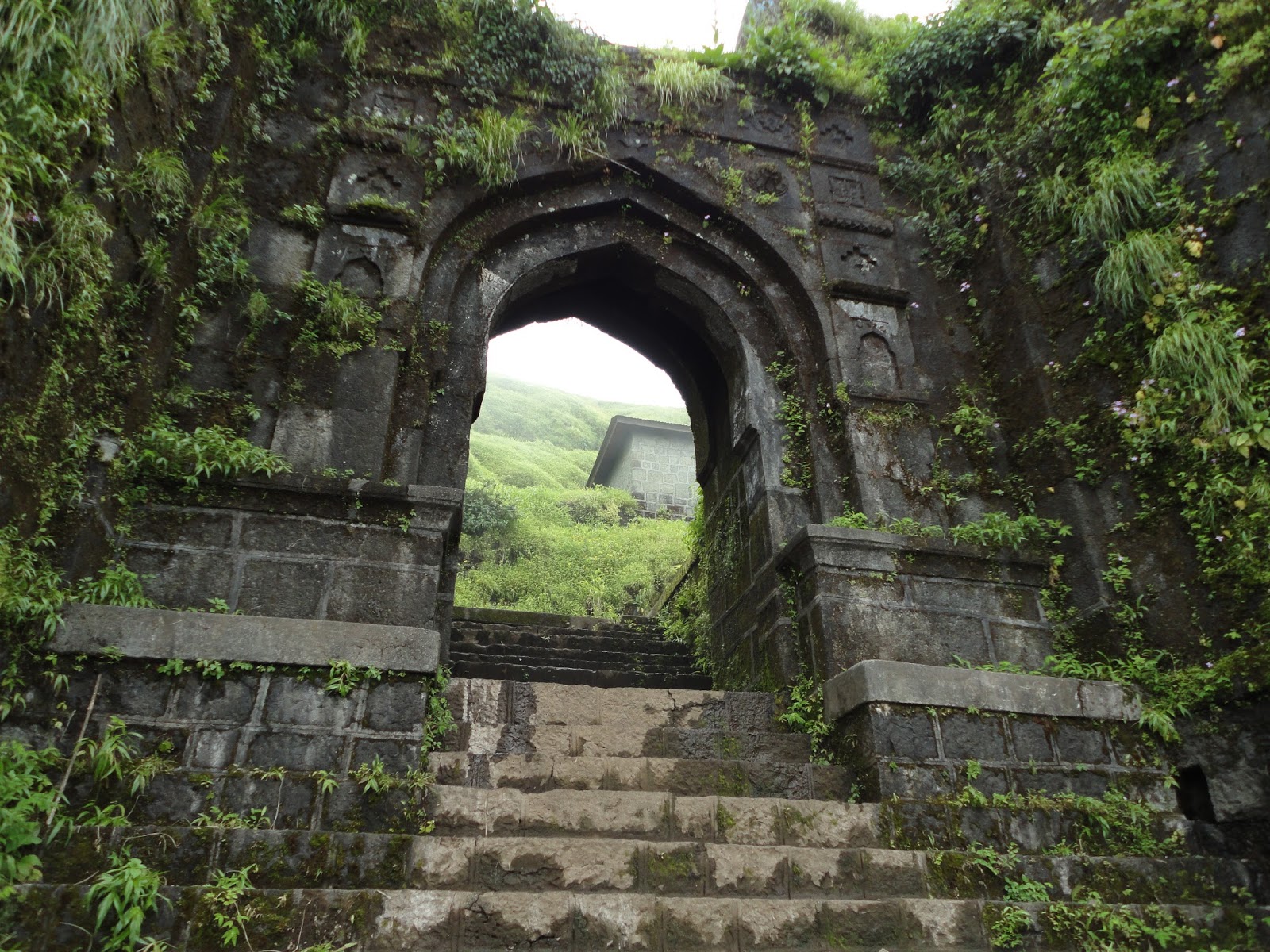
After a few more hours through some boulders, rough patches and steep climbing we reached the ‘Chor Darwaza’ entry point to the fort!
 |
 |

Even inside the fort, the scenic views continued to amaze us. Just as we moved in, a wave of clouds crossed over and it started pouring.. a first reminder of the monsoon time! This made the place all the more magical.
 |
 |
Right in front of the entry point is the Padmavati lake, a pool which is a refreshing sight to sore eyes. Locals say that the pond is over 90 feet deep! Puneet and Shubho turned adventurous and took a dip in the pool with the aid of waist-bound rope lines.
 |
 |
While exploring the lower portions of the fort, it was good to see a lot of walls intact, though sadly none of the core structures seemed to have survived the ravages of time and warfare. Inspite of the fort being declared a World Heritage Site, sadly there are no details provided on the history or site map within the fort. In fact, almost all of the few name boards put up have their paints worn out and are of no practical use.
 |
 |
 |
 |
Just as we were exploring, the food was delivered on-time, right next to the Padmavati temple! The group lapped up the yummy food and not a morsel was wasted. Then, we checked out the other remnants and proceeded towards Balle Killa, which is the highest point of the fort.
 |
 |
The trek up to the Citadel turned steeper with near vertical climbs. The iron railings put up years ago have aged and worn out in many places, making the climb tricky. The ‘Maha Darwaja’ then becomes visible and makes up for a
grand entrance to the citadel. This being the highest point of the fort (~4200
ft), most of the time, it is in the midst of the clouds. Here there are few more
structures, some of which have name boards, but all uniformly and completely destroyed.
 |
 |
 |
 |
 |
We then made the descent down, back to the Padmavati temple and regrouped to begin our journey ahead to the Torna fort.
 |
 |
It was 5 PM and we were already couple of hours behind schedule. We proceeded towards Sanjivani machi.
 |
 |
 |
 |
Clouds, rain and the sun kept playing hide-and-seek throughout the
way. Every few moments there was complete cloud cover with only a few feet ahead visible, only to be immediately followed by a bright sunny view.
 |
 |
 |
 |
After reaching the boundary walls of Sanjivani machi, we
couldn’t locate the Alu Darwaja which offers an exit point to proceed towards
Torna. After close to 30 minutes of frenetic exploration, we finally located the right trail
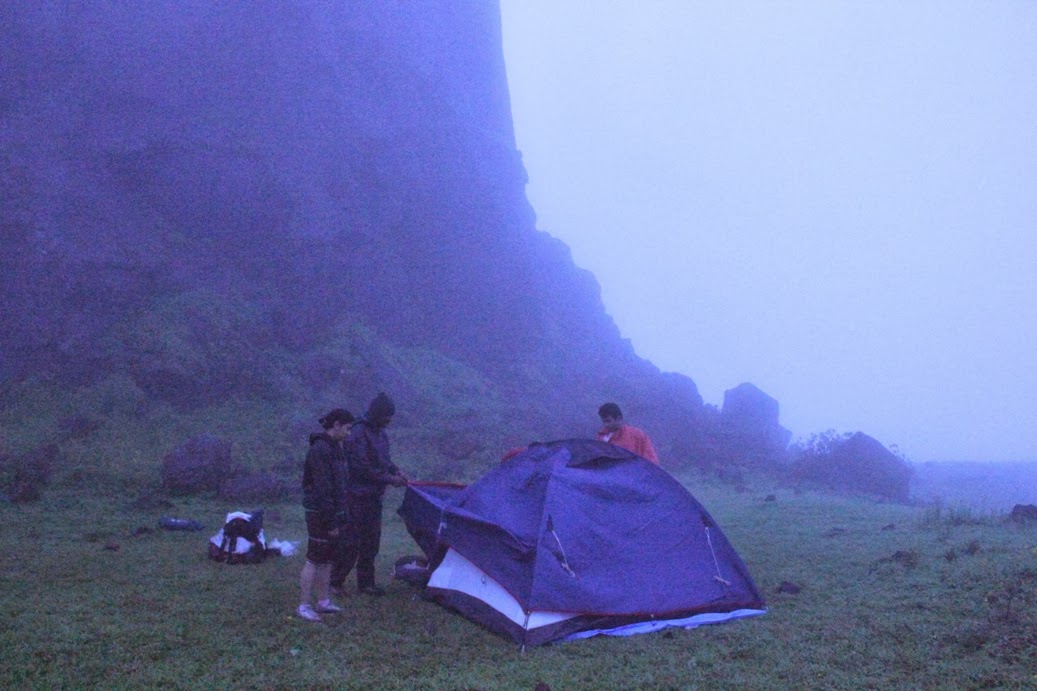
and moved out of the fort. However, it was 6.30 PM by then and visibility was becoming an issue. Considering the less number of torches available with the group, we decided to
camp right outside the fort walls. A group setup tents, while others collected enough
firewood to keep campfire on for the night. After a lean dinner, thanks to Nandita's stock of packed
chapattis and masala oats which we cooked over the camp fire, we had a few rounds of interesting games. Finally the group
settled in the tents and soon fell asleep.
 |
 |
We woke up at 5.30 in the morning. After some bouts of exercises and light cereal breakfast, the journey was resumed at 7 AM, by when the visibility was manageable. With a heavy heart, we bid adieu to Rajgad, one of the finest forts in the country, steeped with rich history.
The path started with a very steep and near-vertical
drop followed by trek over the hill-top for a few kilometers.
Then the path
criss-crossed up and down through several valleys and shrubs, finally taking us
to a place called Paal Khid, where the trail intersects with a semi-tar road. At a very small distance from Paal Khid is a small village
and few huts. We found a small tribal temple on the way. With no time to rest at any of these places, we continued on the path up a series of interconnected hills, wherein the path alternated through dense cover of small trees and at times right on the hill top.
 |
 |
 |
 |
 |
 |
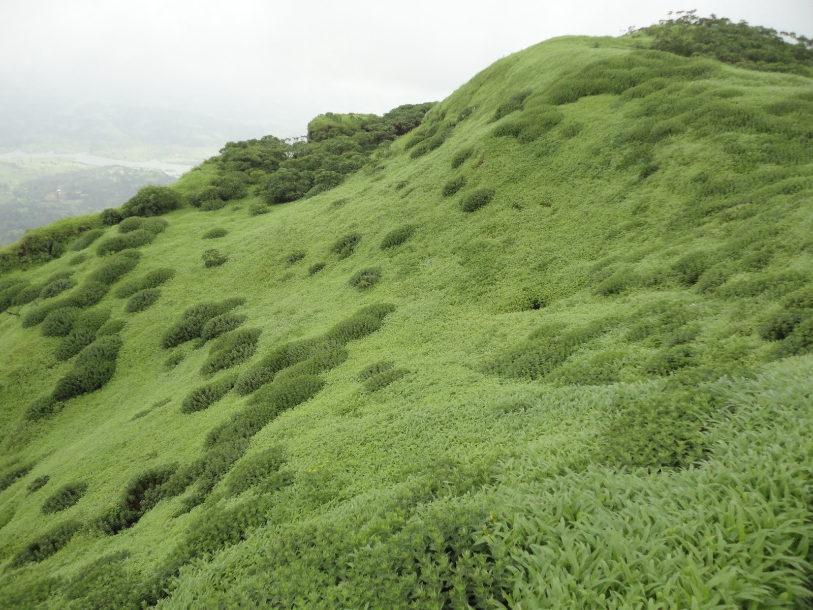
Finally, the outlines of the Torna fort started emerging. There were some very steep climbs through hill and rocks, wherein we could see the steep drop onto the valley on either side! But this patch was mesmerizing as we walked right through the clouds and found a assortment of small flowers of varied clours dotting the grass-covered hills on either sides. The valley on either sides of the mountain was again lush green with bright patterns, shrubs and flowers.
 |
 |
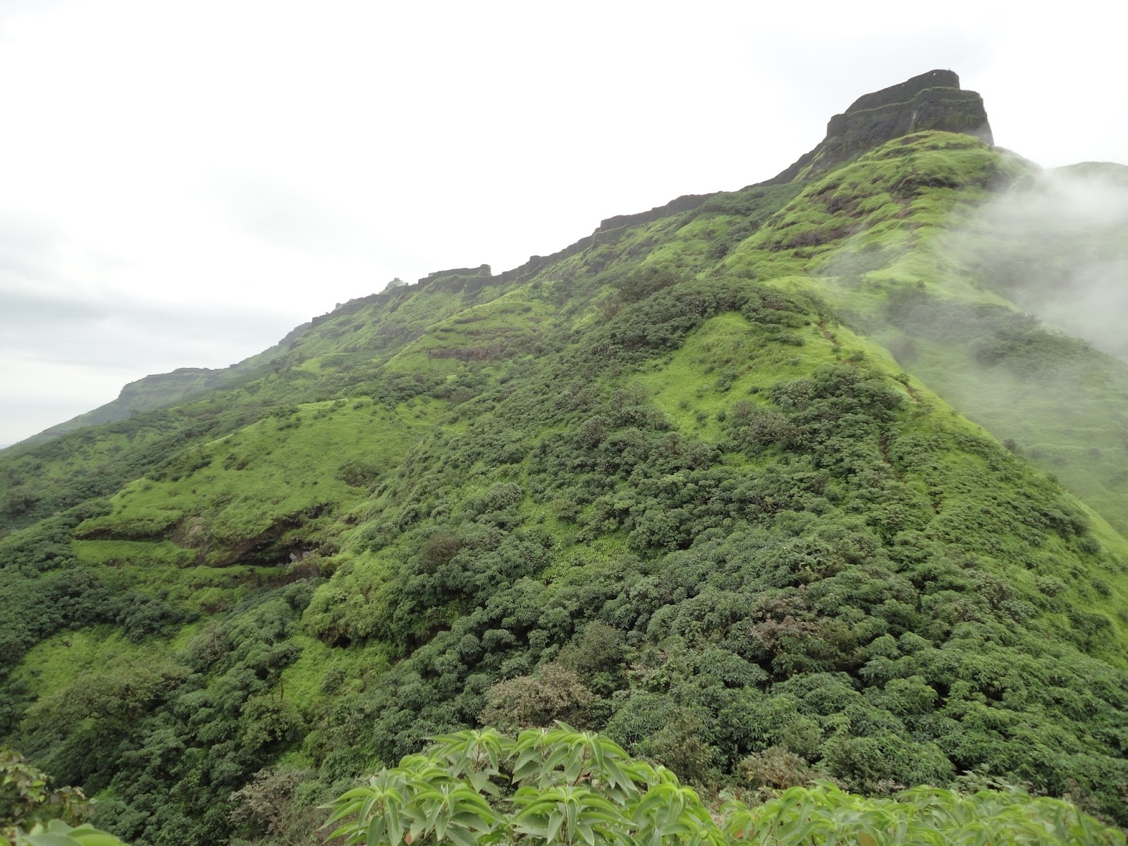
This finally took us to the base of the Torna fort, another
gigantic construction on a very tall hill. Just when we thought that the
adventurous part was over, Torna fort sprung more surprises!
The trail for scaling the Torna fort through Budhala Machi took
us to three sets of completely, literally
vertical climb over wet, slippery rocks at 90 degrees overlooking a deep drop
into the valley, at times from both sides! Turning a little jittery about the
climb, the cameras went into the packs and there was deep concentration on the
techniques to overcome the obstacle.
 |
 |
 |
 |
Overcome, we did! Torna fort has thicker green vegetation over most portions of the fort and is even more pleasant to the eye.
 |
 |
After a few more points of steep climb, we captured the Torna fort (~4600 ft), the highest fort in Pune district. It has near perpetual cloud cover making visibility restricted to a few feet at a time. It was a great feeling as a group to have successfully completed the trek. Puneet had planned a special way to end the trek by carrying a pack of Rajbhog (+1 kg!) with him all the way from Hyderabad. The group enjoyed the dessert and took team pics on top of the hill.
 |
 |
 |
 |
By this time realization dawned on us that this was one place where every view seen
was worth capturing and hence practically impossible unless one does a complete
video shoot! The incessant photographs had completely drained out the batteries and the cameras gave up during the final descent down from the Torna fort. This
route was a little tricky as well, with many parts having a steep descent over rocks, but with broken iron railings for a change.
Upon reaching the fort base, the trail took us a further couple of kilometers
down to the nearest village, Velhe, which we reached at 7.30 PM. With a bus
booked for Hyderabad from Pune at 11 AM, we quickly had some hot Poha from a
village eatery and took a cab back to reach the boarding point on time.
This was an amazing experience of getting closer to nature, packed with learnings for me and this
definitely counts amongst the best treks I have done till date.
